| |||
|
|
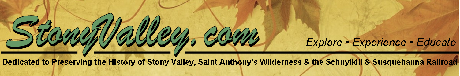
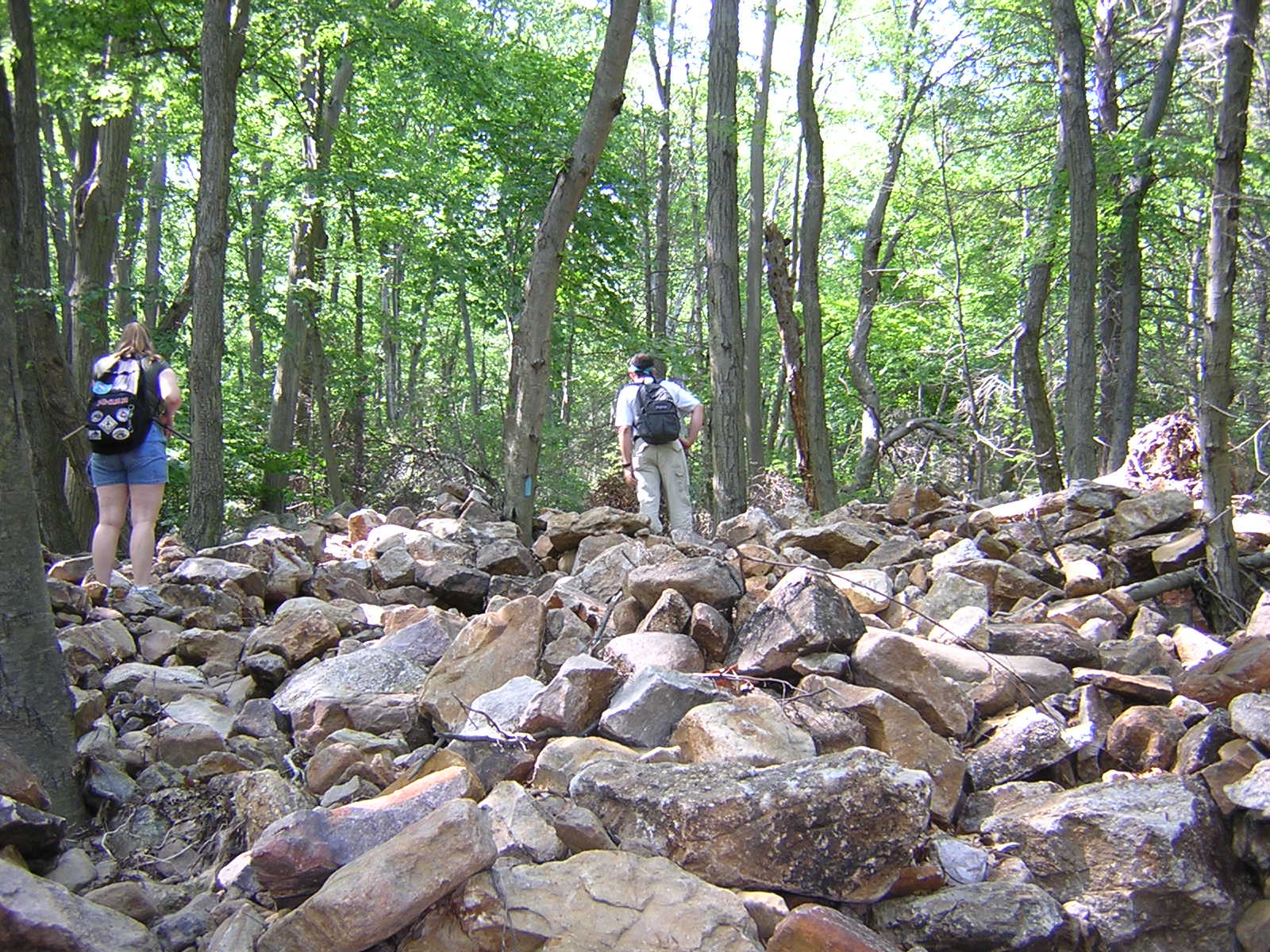
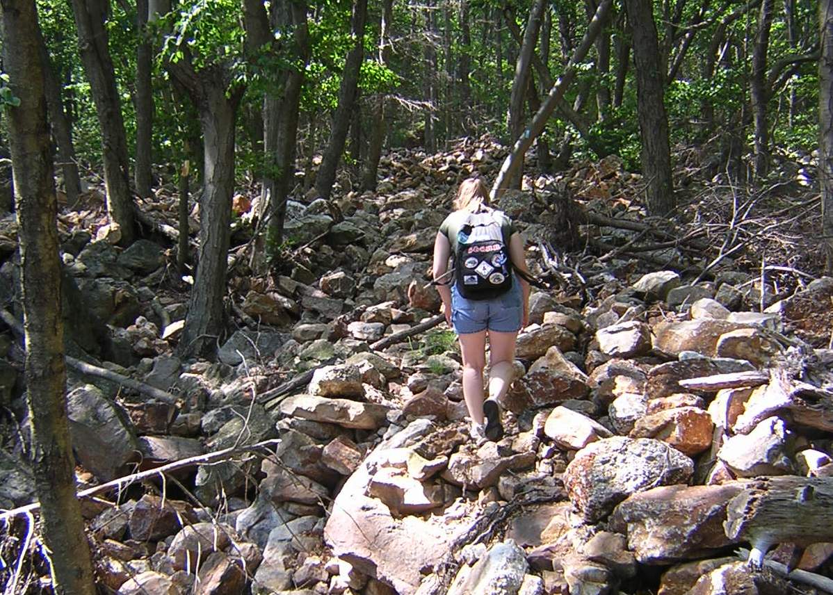
Top Ten Historic Sites in Stony Valley & Surrounds Unfortunately for travelers who desire easy accessibility they can only enter from the Clark's Valley side, Route 325 at the Stone Tower Trail Parking Area. Hurricane Ivan destroyed half the incline in 2004 (the damaged incline is shown below). The remaining side is still in pristine condition (shown right).
Photographs by Annette (Watts) Logan DIRECTIONS: From I-81, take exit 85B toward Fort Indiantown Gap, then merge onto Fisher Ave. Travel 0.5 miles and turn left onto Asher Miner Road. Continue 2.2 miles on Asher Miner Road until it becomes Moonshine Road / PA-443. Continue 1.3 miles and follow signs to Second Mountain Hawk Watch. Cold Spring Road will become dirt before reaching the crest of the mountain. Instead of turning right at the mountain's crest, continue north one mile down into Stony Valley and the Cold Spring Parking Lot. Please be advised that Cold Spring Road is closed from November 31 to March 31 each year due to not having winter maintainance. The road is an unmaintained dirt road into the valley, so high clearance four-wheel drive vehicles are suggested. Park and walk through the gate at Cold Spring, turning right up the hill when you see a stone wall. Walk up the hill and you will reach the rail-trail. Make a left on the rail-trail, and walk 2.2 miles west towards Dauphin, until you reach the community of Yellow Spring. Next to the left bridge, the Incline Plane Trail will begin to your right. Please be advised the trail is rough and takes approximately 1.5 miles to reach the summit. Use State Game Lands #211 Map 2 of 3
| ||
StonyValley.com was created and is maintained by Schuylkill & Susquehanna Railroad Historian, Brandy M. Watts Martin. Copyright 2013. | |||


 Once traversing 2.5 miles over the steep grade of Third Mountain, this incline plane lends an air of wonder to any engineering student. Originally constructed in 1908 by James Russell Glass to haul timber from his lumber lands in Clarks Valley, south to the Schuylkill & Susquehanna Railroad in Stony Valley, the estimated cost of the project was a mere $10,000. The incline plane gave Glass the advantage in hauling lumber in this mountainous region, and with the use of a gravity-assisted hoisting engine at the mountain’s top, made him able to dispose of 20 head of horses.